
Topo twisting on the Ella Range
A north to south traverse between Mole Tops and McKellar Stream
Words and pictures, Peter Laurenson

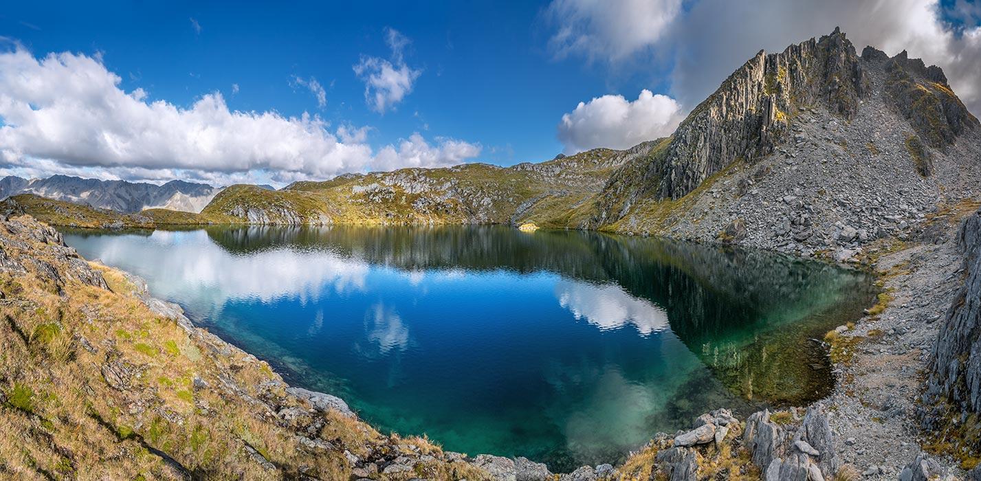
Looking south to Mt Watson
‘Well, that’s a fail’ I thought as my gaze dropped down very steep broken scree until it rolled over into even steeper terrain, concealing what lay beyond. To my left was a wall of near-sheer cliffs.
My buddy on this trip, Shaun Barnett, had been doing a masterful job navigating our way along the Ella Range, occasionally travelling on the jagged, broken schist on the ridge itself, but mostly picking just the right spot to swap from east to west, linking one basin with the next.
We hadn’t put a foot wrong since reaching Mole Tops on the morning of the previous day. Now, as we sat enjoying lunch while pondering the way ahead from the saddle just west of Pt 1972m, with just one more ridge to cross before we began our descent to McKellar Stream, Shaun asked ‘What do you reckon, we seem to have a choice of two saddles here?’ Considering the innocuous looking contours on our topo map I replied ‘The right one looks to have easier access and we should be able to traverse left down the other side of the face, if need be, to reach the descent chute.’ Wrong!

Shaun ponders our choice of saddles
Given the amount of mountainous country we’d covered in the past two days it seemed a world away since we’d set off from Christchurch three mornings ago. The forecast indicated clearing rain, which had happened, followed by a three day fine window before rain was expected to return.
So on the first day, after parking the car at the bottom (500m) of the Jameson Ridge Track, we’d climbed up through beech forest, initially on quite a steep track, which flattened out as the vegetation became more stunted. Light rain had arrived as we breached the tree line not far from Mole Hut (970m) and by the time we stepped inside the four bunker, it was starting to rattle on the roof. Although we got nothing dry over night, we slept warmly and contentedly as the rain poured down.
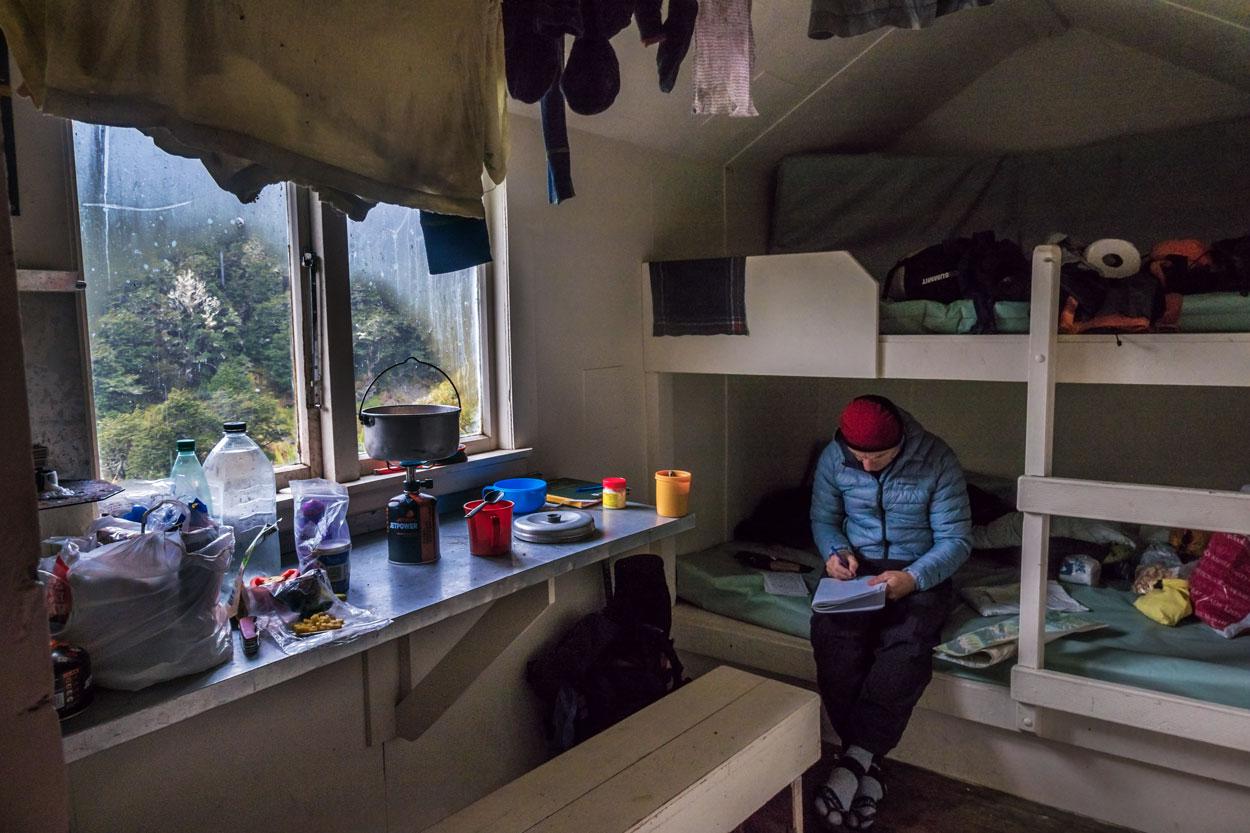
Inside Mole Hut
It only took about an hour to reach the ridge above Mole Tops next morning in bright sunshine. Our intended route wasn’t marked on the map but, at least initially, we followed a fairly well-worn trail up to 1,600m, marking the lower, northern end of the Ella Range. To the east lay the Mole Tops basin, bejewelled with gleaming, freshly topped-up tarns. In the bright, clear conditions, with the Mahanga Range just across D’Urville Valley to the east and the Matakitaki Valley and Nardoo Range to the west, we were immersed in magnificent landscapes no matter where we looked, or pointed our cameras.
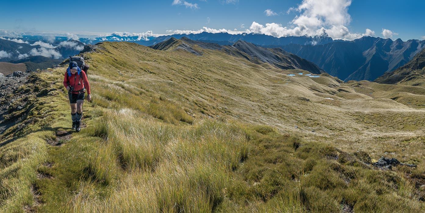
Heading south, Mole Tops behind
Both Shaun and I love being up on the tops. We’d hoped to be able to travel along the ridge as much as possible, but by the time we reached the first saddle of our journey, just west of Pt 1770m, it was already apparent that the ridge tops, comprising mostly of exposed and weathered schist, were going to at best make for very slow going, and often would require a rope. So the topo whisperer got out his map and began deftly picking the best route along the range.
But before we departed our first saddle there was the small matter of Pt 1770m to address. Just a quick packless scramble rewarded us with a veritable tarn-fest – north to the Mole Tops and south to another cluster of gleaming beauties in the basin on the east side of the range.
Looking south from Pt 1770m
Beyond that basin we climbed to another saddle; dropped in to another east-side basin, then up to a shoulder west of Pt 1785m; down past another lovely tarn on the east-side; back to the ridge briefly, before dropping east again underneath the summit of 1,871m Mt Watson.
I’d hoped we might climb Mt Watson, but by the time we reached the ridge south of the peak, the broken, rocky mayhem confronting us dampened my ambitions. Instead we opted for a stint of ridge top travel heading south towards Pt 1870m. Clambering amongst the schist towers we didn’t last long, dropping east again with ever more expansive views into the D’Urville.

On the ridge south of Mt Watson
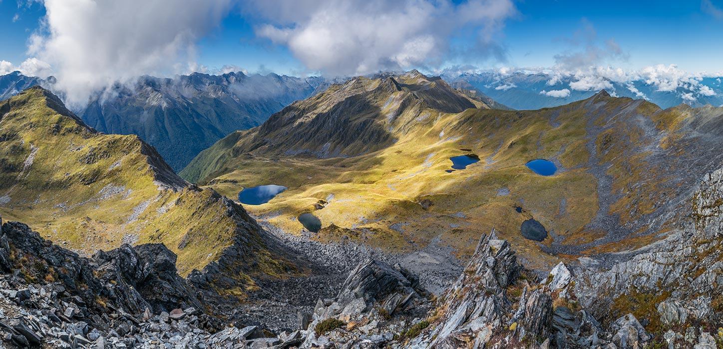
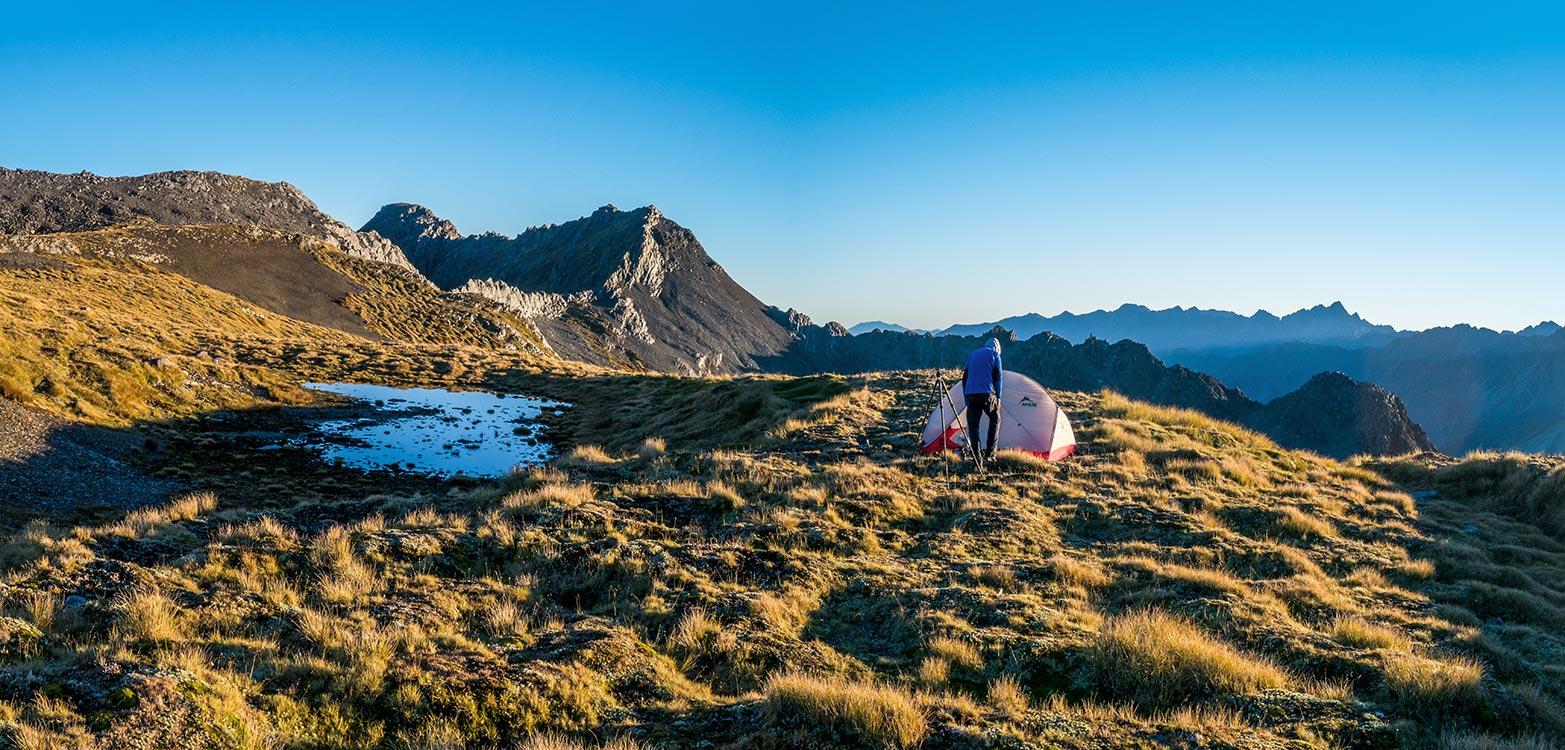
Beyond a particularly smashed-up wall of schist that fed a large open scree field beneath it, we spotted two large tarns ahead, nestled about 50 metres below us beneath Pt 1916m. Where we stood on an open tussock field, beside two much smaller tarns, with easily accessible Pt 1860m just west of us on the ridge and a superb view into the D’Urville to the east, I managed to persuade Shaun that we’d get more photographic bangs per buck up there than if we descended to one of the beautiful tarns to camp. ‘Yeah, ok. This spot will be awesome for sunset and sunrise too. And we can just pop down there before dinner to check out the tarns.’
It had taken us about eight hours to reach our campsite. But now free of our packs and spurred on by truly magnificent scenery, we headed for the first tarn. This was nice, but beyond a small spur, its companion looked even better. ‘This could be the most beautiful tarn I’ve ever seen’ enthused Shaun as he set up his tripod. And that was high praise indeed coming from the man who’s seen more of New Zealand’s backcountry than just about anyone.
The two tarns south of our camp spot
The tarn beneath Pt 1916m
My shutter finger agreed with Shaun, but after a while, I left him to the tarn and climbed back up above our tent to Pt 1860. Now the sun was setting and from the ridge top it was spectacular. To add even more drama, as the light began to dim, a big rolling band of low cumulus filled the D’Urville, catching the last of the sun’s pastel light.

Mt Cupola at dusk

A view over the D’Urville from our camp at sunset
The night was calm, with the Milky Way out in full splendour by the early hours of the morning. Of course we were up for sunrise, and that also met expectations, delaying any preparations to continue our journey south. Eventually, about 9 am, we were again on the move, headed for a saddle just west of Pt 1916m.
Getting ready to head on south
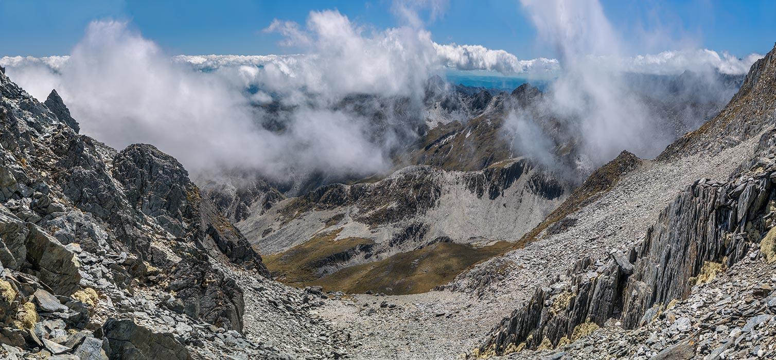
While yesterday we’d spent most of our time on the east side of the range, today we’d spend almost all of it on the west side. This meant a change of scenery as we looked west to the Nardoo Range. As we moved south towards Mt Ella – at 2,253m, the highest point in the range, the entire landscape was also getting higher and rockier.
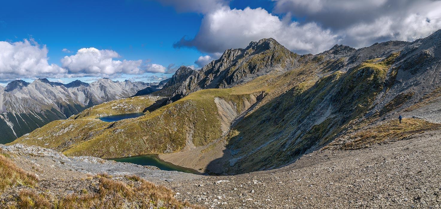
Beyond Pt 1916m we sidled high to a saddle, then down into a wide tussock basin beneath Pt 1931m, where another tarn mirrored its surrounds. After quenching our thirst we again climbed to have another crack at ridge top travel, until bluffs forced us down a steep staircase. Beyond there we found ourselves at our lunch stop west of Pt 1972m, considering our choice of saddles above McKellar Stream.

Back on the ridge, north of Pt 1972m
I’d actually enjoyed the hot slog up to our first choice of saddles – it reminded me a bit of approaching a Himalayan pass. My reminiscing was abruptly cut short though, when the drop on the far side of the saddle revealed itself. Shaun soon joined me. ‘Oh …’ He wasn’t keen to retrace our steps back down more than 100 metres, then to climb again to the other slightly higher saddle at 2,000m. ‘I’ll drop my pack and do a recce – see if the ground beyond the rollover is descendible.’ I tried to dissuade him, but off he went. It wasn’t long before he was back though – the slope was treacherously loose and steep underfoot and he quickly realised that tackling it with a pack would be asking for trouble with a capital T. We also briefly flirted with a route over the tops between the two saddles, but really that was a desperate fantasy. So back down we went.
Looking north, back down to Shaun, bottom left of centre, from the ‘wrong’ saddle
It didn’t actually take long before we arrived back up on the correct saddle. It was nice to see an unimpeded route all the way down to the head of McKellar Stream, which sat 800 metres below us – a small area of tussock surrounded by an unusual horseshoe of forest.

Descending south, from the ‘right’ saddle, to the head of McKellar Stream
Down we went. Down, down, and more down. Eventually, on level ground again in the tussock, it took a while to find a sufficiently flat spot to pitch the tent. With a bit of walking-axe-assisted weeding we got there, grateful to be able to relax, rehydrate and watch the evening unfold. At 1,200 metres, we enjoyed the absence of sandflies. The 2,000 metre saddle high above provided pause for thought. By climbing other scree slopes further south it’s possible to access the jagged summit ridge of Mt Ella; but not on this trip thanks.
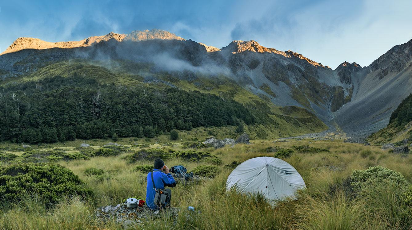
From our camp at sunset, looking back up to the 2,000m saddle
Cloud action warned us of a change in the weather, which gelled with the forecast before we set off four days earlier. Our route down McKellar Stream proved to be more well-worn than we’d expected, once we intersected with the main trail. In the upper reaches we passed beautiful cascades as we descended through pleasant forest. About two thirds of the way down to the Matakitaki was a very steep, slippery and difficult to follow section. Starting at about 900 metres, this took us in to the wasp zone too – they were everywhere, injecting an unwelcome edginess to the proceedings. As the gradient eased off again fallen trees made staying on route more challenging.
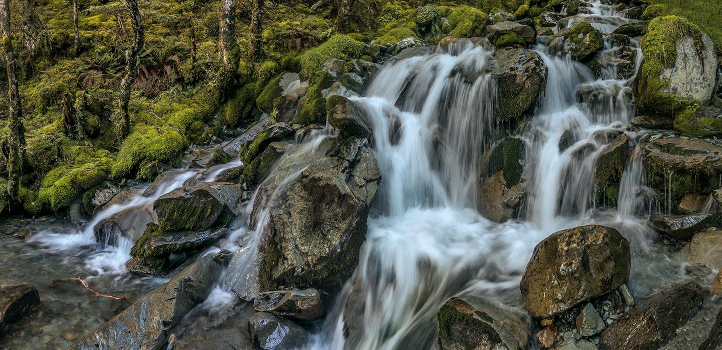
A particularly photogenic cascade near the top of McKellar Stream
All of a sudden we popped out of the scrub on to the wide open Lower Matakitaki Route. ‘About 12kms of plain sailing from here’ Shaun reflected as he recalled the last time he’d been this way a couple of decades ago. He was right, mostly. However, storm damage and river erosion, combined with bush lawyer, wasps and an apparent lack of track maintenance for some time, conspired to keep us on our toes. At some points the trail alternated from being fit for 4WDs to nothing but a sheer cliff with the Matakitaki surging directly below.
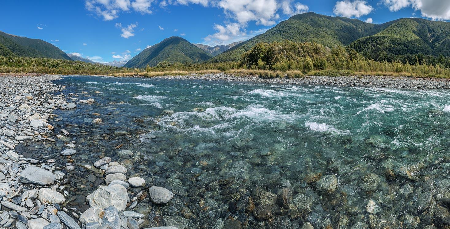
The Matakitaki River, soon after exiting McKellar Stream
Late afternoon we set up camp on a soft grassy flat beside the Matakitaki, near where the Watson Creek Route heads east and up. Although we could have pushed on for another hour and half to the car we decided we’d had enough for the day and the spot was conducive to relaxing – except for the sandflies! Even covering up and liberally apply repellent didn’t stop them. Eating had to be a dynamic, in-motion process, and just clambering in to the tent allowed a hundred or so of the little demons in with us. Even next morning before dawn there was no respite. It was then that the first of the rain arrived, so the humid conditions didn’t help either. This did at least incentivise a rapid pack up and exit/retreat.

The invaders
By 9 am we were enjoying breakfast and a decent flat white at Rivers Café in Murchison, without a sandfly in sight.
For more captioned images and the route map go to https://www.occasionalclimber.co.nz/browse-images-2/new-zealand-south-island/nelson-lakes-browse/ella-range-circuit/